Neighbourhood Planning
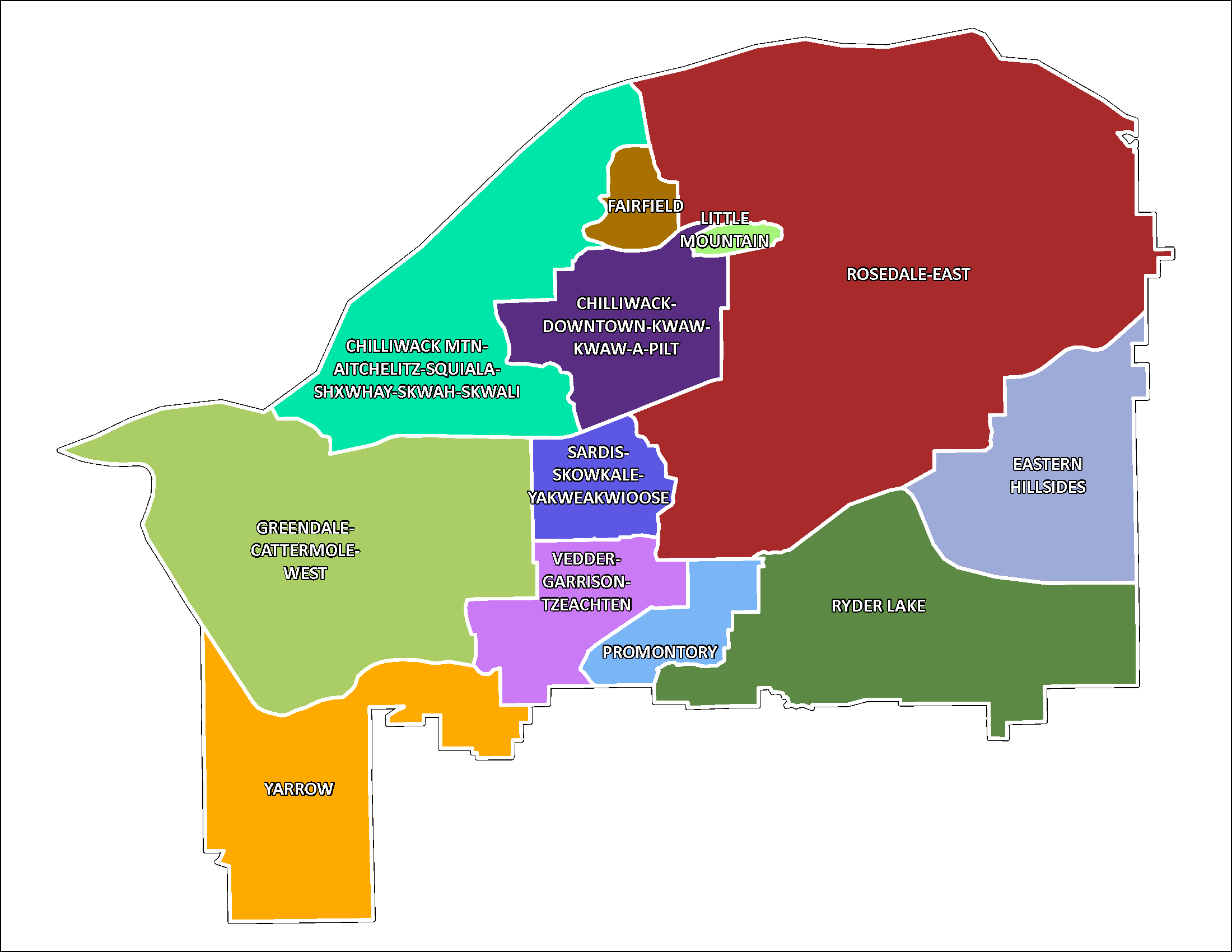 Chilliwack has many distinct neighbourhoods, which generally fall into three categories according to their shared characteristics: urban areas, hillside areas, and rural areas.
Approved or endorsed neighbourhood plans are found in the links provided below, and many are adopted by Council as appendices to the City's 2040 Official Community Plan (Schedule D).
A neighbourhood plan is a tool to help residents identify a common vision for their neighbourhood, prioritize neighbourhood goals and identify options for achieving them, and convey the types of projects a local community supports. It also helps Council understand how residents want their neighbourhood to develop over time.
Timing of redevelopment is dependent on the market and the interest of property owners, and successful rezoning and development. Neighbourhood Plans are reviewed and adjusted as needed to ensure they remain relevant to the neighbourhood's aspirations and needs.
Urban Areas
As nearly 70% of land in Chilliwack is in the Agricultural Land Reserve and not available for development, the City’s growth management strategy (Official Community Plan) primarily focuses on the redevelopment, renovation, and densification of existing urban areas within the urban growth boundary where a diverse range of services and amenities already exist.
Hillside Areas
The City's growth management strategy directs selective growth to designated hillside areas that are supported by municipal services and governed by Comprehensive Development Area Plans.
- Chilliwack Mountain Comprehensive Development Plan
- Eastern Hillsides Comprehensive Area Plan
- Promontory
Rural Areas
The City's growth management strategy limits growth in rural settlements through retaining the existing rural settlement boundaries of Greendale, Rosedale and Yarrow Town Centre.
First Nations Communities
The City of Chilliwack is located on the traditional, ancestral, and unceded territory of the Stó:lō Coast Salish peoples. More than ten First Nations are part of the community and share borders with the City of Chilliwack.